Dudley No 2 Canal (Lapal West)
Dudley No 2 Canal (Lapal West)
Flight along the route today (Flying East)
Flight along the route today (Flying West)
* Image colourised from black and white original

1:25000 Ordnance Survey Map 1920

Halesowen (Google Earth) 1945

Hawne Basin and Mucklow Hill (Drew Blackcountrymagnets) 1970s

Hawne Basin (Photographer Unknown)

Heywood Forge Bridge

Limit of Navigation 1987 (Robin Webster Combeswood Canal Trust)

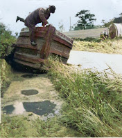
Collapsed foot bridge 1991 (Combeswood Canal Trust)

Limit of Navigation (Combeswood Canal Trust)

Mucklow Hill (Combeswood Canal Trust)

Aerial Mucklow Hill 2022 (Andy Tidy)

Mucklow Hill 1970 (Alan T Smith, DCTT)

Mucklow Hill 1993 (Alan T Smith, DCTT)

Mucklow Hill 1972 (Ian Huselbee)

Mucklow Hill 1993 (Alan T Smith, DCTT)

Mucklow Hill 1991 (Combeswood Canal Trust)

* Heywood Wharf (TW King Collection)

Mucklow Hill 1949 (Aerofilms)

Heywood Wharf and Bridge (BCLM)

Mucklow Hill 1949 (Aerofilms)

Heywood Bridge looking East 1974 (Halesowen Library)

Heywood Bridge looking West (BCNS)

* Heywood Bridge looking West (Rodney Weaver RCHS)

Mucklow Hill 1949 (Aerofilms)

Heywood Bridge 1954 (T Eggington, Worcestershire Archives)

Heywood Bridge 1959 (HA Ashmore, Worcestershire Archives)

SE from Heywood Bridge 1959 (HA Ashmore, Worcestershire Archives)

Leasowes Park (Steve Crook Collection)

Leasowes Park 1954 (T Eggington, Worcestershire Archives)

* Leasowes Park 1959 (David Morris)

Leasowes Park (Alan T Smith, DCTT / Neil Pitts, Paul Collins Collection)

* Leasowes Park 1959

Leasowes Park (Hugh Compton, RCHS)

Leasowes Embankment 2022 (Andy Tidy)

Leasowes Embankment (Bing Maps Bird's Eye)

* Leasowes Park

Leasowes Park 1970s (John Whitehouse)

Near Foredrove Bridge (Will Suter, BCNS)

Halesowen (Cambridge Air Photo)

* Near Fordorve Bridge 1954 (Sid Godfrey)

Fordrove Bridge (Dudley Teachers Centre)

Fordrove Bridge (Dudley Teachers Centre)

* Fordrove Bridge 1950s (Phil Waldren)


East to Manor Bridge (Tony Gregory, BCNS)


* Manor Bridge being demolished 1963 (Steve King)

Manor Bridge (Tony Gregory, BCNS)

Manor Bridge (Tony Gregory, BCNS)

* Manor Way looking East 1920 (TW King)

West to Manor Bridge

Towards Manor Bridge (Steve King)

East of Manor Way 1967 (Peter Freakley, DCTT)

Lapal West (Google Earth)

* Near Lapal 1920 (TW King)
* Near Lapal 1920 (TW King)

Pumping Engine Narrows 1962 (DCTT)
%201997%20028%202816a.jpg)
Pumping Engine Narrows (BCLM)

Pumping Engine Narrows (BCLM)

West from Lapal Portal 1073 (Dennis Hadley, RCHS)

* Lapal Tunnel West Portal 1909 (HT Bolus Worcestershire Archive)

Lapal Tunnel West Portal 1948 (Anne Smith)


* Lapal Tunnel West Portal 1957 (Arthur Watts CRT)

West Portal 1973 (Dennis Hadley, RCHS)

* Lapal Cottage 1901 (Mark Bryan)

* House by Lapal Tunnel

* Approaching Lapal Tunnel 1957 (Arthur Watts CRT)

From West Portal (Tony Gregory, BCNS)

* Lapal Cottage 1928

West Portal Site 2022 (Andy Tidy)

Lapal West 1947 (Britain from Above)

* Lapal Tunnel 1961 (Edwin Fasham)
Dudley No 2 (Lapal East)
These images are reproduced for ease of research are are not the property of this blog, and as such should
not be used for commercial gain without the explicit permission of the owner (whoever that may be).


Comments
Post a Comment