Dudley No 2 Canal (Lapal East)
Dudley No 2 Canal (Lapal East)
Flight along the route today (Flying East)
Flight along the route today (Flying West)
* Image colourised from black and white original
1:25000 Ordnance Survey Map 1920
Selly Oak 1945 (Google Earth)
Selly Oak Junction Bridge 1960 (Phyllis Nicklin, University of Birmingham)
Selly Oak enhanced (Lapal Canal Trust)
Selly Oak 1920 (Britain from Above)
* Selly Oak Stop Lock (TW King Collection)
Selly Oak 1920 (Britain from Above)
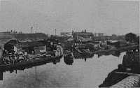
* Harborne Wharf 1920s
Battery Park from Harborne Lane Bridge 1953 (Phyllis Nicklin, University of Birmingham)
* Park Bridge from Harborne Lane (Dave Roberts)
Selly Oak 1920 (Britain from Above)
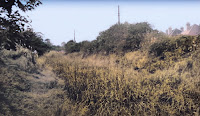
* Selly Oak Park looking East (Dave Roberts)
* By Reservoir Road (Dave Roberts)
* Weoley Castle from Somery Road (TW King Collection)
* Somery Road 1900's (Rupert Rid)
* Somery Road Bridge 1951 (HNBC Philip Weaver)
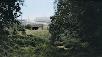
* Approaching Lapal Tunnel (TW King Collection)
California, Lapal Tunnel West Portal (Cambridge Air Photo)
* Lapal Tunnel East Portal 1920 (TW King Collection)
Lapal Tunnel East Portal 1953 (Phyllis Nicklen)
* Lapal Tunnel East Portal 1920 (TW King)
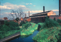
California Brickworks Basin 1941 (Paganel Archives)
California Brickworks, Canal to the right
(King Edward VI Five Ways School Local History Digital Archive)
(King Edward VI Five Ways School Local History Digital Archive)
California Brickworks from Tunnel Portal
(King Edward VI Five Ways School Local History Digital Archive)
* Lapal Tunnel 1961 (Edwin Fasham)
Dudley No 2 (Lapal West)
These images are reproduced for ease of research are are not the property of this blog, and as such should
not be used for commercial gain without the explicit permission of the owner (whoever that













Comments
Post a Comment