Lichfield Canal (Ogley Locks) Part 2
Lichfield Canal (Ogley Locks) Part 2
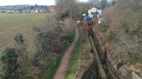
Flight along the route today (Flying East)
Flight along the route today (Flying West)
* Image colourised from black and white original
1:25000 Ordnance Survey Map 1920
Sandfields
* To Lock 19 looking West 1924
* East to Sandfields Pumping Station
* Sandfields Pumping Station
* West to Chesterfield Road and Sandfields Bridge
* East to wharf Lock 20
London Road and Birmingham Road (zoomed in)
* Shortbutts Lane Lock 21 1955 (Arthur Watts CRT Archives)
* St John's Wharf and Lock 23 1948 (Duncan Moore, RAF)
* West to London Road Bridge 1989 (Duncan Moore)
Borrowcop
Cricket Lane 1979 (Cambridge Air Photos)
* West from Cricket Lane 1989 (Duncan Moore)
* Looking along Cricket Lane to the Bridge (Touluru)
* Above zoomed in on the Bridge
Lock 24 (Christine Howles)
Lock 24 (Touluru)
Lock 24 (LHCRT)
Borrowcop Locks 26-24 1933 (Britain from Above)
Borrowcop to Darnford (Meridian Airmaps)
Freeford and Lock 27 1933 (Britain from Above)
Around Darnford 1970 (Roland Russel, Hugh Compton Colleciton, RCHS)
Huddlesford
Darnford
Lock 28 Darnford 1933 (Britain from Above)
Lock 28 Darnford 1933 (Britain from Above)
Darnford 1933 (Britain from Above)
* Darnford Lane 1989 (Duncan Moore)
* Lock 30 1989 (Duncan Moore)
* Lock 30 Cottage 1955 (Arthur Watts CRT Archives)
* Watery Lane Bridge (Hugh Potter)
To Part 1
These images are reproduced for ease of research are are not the property of this blog, and as such should
not be used for commercial gain without the explicit permission of the owner (whoever that may be).
These images are reproduced for ease of research are are not the property of this blog, and as such should
not be used for commercial gain without the explicit permission of the owner (whoever that may be).


Comments
Post a Comment