Hatherton Branch
Hatherton Branch
Flight along the route today (Flying East)
Flight along the route today (Flying West)
* Image colourised from black and white original

1:25000 Ordnance Survey Map 1920
Western End


Hatherton Junction 1967 (Edwin Shearing, RCHS)

Hatherton Junction 1965 (Ian Huselbee)
 |
* Hatherton Junction (Barrie Harley? Cannock Library) |

* Hatherton Junction Bridge Calf Heath 1955 (Arthur Watts CRT Archives)

* Calf Heath Locks 1955 (Arthur Watts CRT Archives)

Calf Heath Locks 1991 (Graham Moore)

Calf Heath Locks (Phil Clayton, BCNS)
Above Calf Heath Bottom Lock 1982 (Marcus Boudier, BCNS)

Calf Heath top lock 2010 (Andy Tidy)

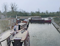
* Calf Heath Marina 1991 (Duncan Moore)

Calf Heath Top Lock (BCNS)

* Calf Heath top lock 1991 (Duncan Moore)

Calf Heath Top Lock (BCNS)

* Calf Heath top lock 2010 (Andy Tidy)

* Calf Heath top lock 1991 (Duncan Moore)
.jpeg)
* The last passage, Calf Heath Top Lock 1955 (John Liley)

Above Calf Heath Top Lock (BCNS)

Calf Heath Top Lock (Touluru)

Above Calf Heath Top Lock (BCNS)

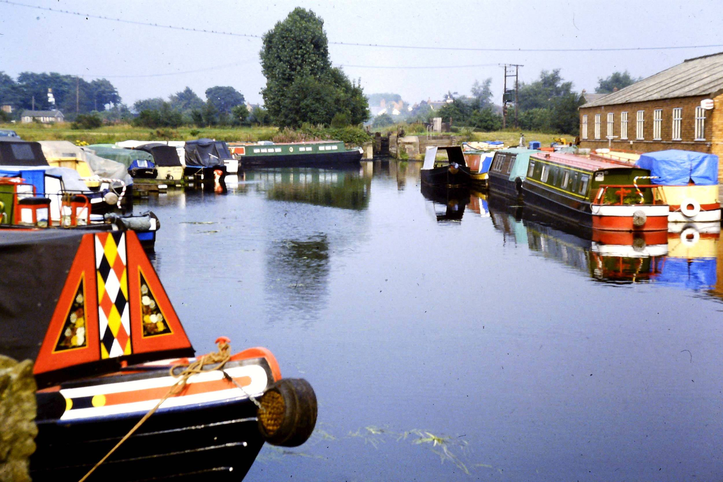
* West from Dog Bridge 1991 (Duncan Moore)
 |
* West from Dog Bridge 1991 (Duncan Moore) |

Dog Bridge far right 1930 (Photographer Unknown)
 |
* East from M6 Cuvert 1970 (Barrie Harley? Cannock Library) |
 |
* M6 Cuvert 1970 (Barrie Harley? Cannock Library) |

Scrawpers End Bridge (Bob May, BCNS)

* Scrawpers End Bridge (David Benson)

West from Scrawpers End Bridge (BCNS)

Scrawpers End Bridge looking West 2010 (Andy Tidy)

*Scrawpers End Bridge looking West 1991 (Duncan Moore)

Scrawpers End Bridge (BCNS)
 |
* Scrawpers End Bridge looking West 1971 (Barrie Harley? Cannock Library) |

From Scrawpers End Bridge looking West 1986 (Trevor Littlewood)

From Scrawpers End Bridge looking West (BCNS)
 |
* Feeder from Gailey Reservoir 1971 (Barrie Harley? Cannock Library) |

* Saredon Mill Bridge looking East 1952 (A Muir White, CRT)

Saredon Mill Bridge (Ian Huselbee)

* Saredon Mill Bridge looking West
 |
* Saredon Mill Bridge looking West April 1971 (Barrie Harley? Cannock Library) |
 |
* Cross Bridge looking East 1970 (Barrie Harley? Cannock Library) |

* Looking East from Cross Bridge

Looking East from Cross Bridge 1986 (Trevor Littlewood)
 |
* Cross Bridge looking East 1970 (Barrie Harley? Cannock Library) |
 |
* Cross Bridge looking West 1970 (Barrie Harley? Cannock Library) |

*West to Cross Bridge 1991 (Duncan Moore)

*West of Cross Bridge 1991 (Duncan Moore)

* Catch Bridge 1991 (Duncan Moore)

* From Catch Bridge looking West 1991 (Duncan Moore)


Cat's (Catch) Bridge being demolished (Eric Wood)

East from Cat's (Catch) Bridge 1986 (Trevor Littlewood)

East from Cat's (Catch) Bridge (Bob May, BCNS)
Eastern End


Bridge 7 (Richard Chester Browne, BCNS)

Meadow Lock (Carol Cooper)

Meadow Lock (Duncan Moore)

Meadow Lock (Carol Cooper)

Bridge 8 (Bob May, BCNS)

Cherry Tree Bridge 8 2010 (Andy Tidy)

West from Bridge 8 (Bob May, BCNS)

Wedges Mill 1950s


Pipe Bridge at Wedges Mill (BCNS)


Wedges Mill Infill (BCNS)

* Aunty Gladys above Wedges Mill Lock (Jim Dawson, Ian Dawson)

Jovey's Lock (BCNS)


Jovey's Lock Paddle Gear 2012 (Bob Williams)

* Bridgtown Bottom Lock (left) Jovey's Lock (right) 1933 (Britain from Above)

* Wedges Mill Bridge on the far left (Jim Dawson, Ian Dawson)

Pipe Bridge at Wedges Mill (BCNS)
Wedges Mill Lock from Wolverhampton Road 1945 (Jim Dawson, Ian Dawson)

* Wedge's Mill Lock and Bridge (Jim Dawson, Ian Dawson)

Wedges Mill Infill (BCNS)

* Aunty Gladys above Wedges Mill Lock (Jim Dawson, Ian Dawson)

Jovey's Lock (BCNS)

Jovey's Lock (Richard Chester Browne, BCNS)

Jovey's Lock Paddle Gear 2012 (Bob Williams)


Bridgtown Bottom Lock 982 (Alan Smith)

From Bridgtown Bottom Lock 1982 (Alan Smith)

Bridgtown Bottom Lock 1982 (Alan Smith)

Rosemary Lock 2? (BCNS)


* Hawkins and Bridgtown locks 2-3 (across the top)

* Concrete lining at Bridgtown 1952 (A Muir White CRT Archive)

* Concrete lining at Bridgtown 1952 (A Muir White CRT Archive)

Bridgtown Midddle to Top Lock 1982 (Alan Smith)

* Bridgtown Top Lock 1971 (Barrie Harley, Cannock Library)

Bridgtown Top & Middle Lock (Bob May, BCNS)

Bridgtown Top & Middle Lock 1965 (Ian Huselbee)


Above Top Lock (BCNS)

Walkmill Lane to Bridgtown Top Lock 1982 (Alan Smith)

Walkmill Lane


Entrance to Hawkins Basin 2012 (Bob Williams)

Aqueduct on entrance to Hawkins Basin 2012 (Bob Williams)

Entrance to Hawkins Basin 2012 (Bob Williams)


* Lift Bridge in the entrance to Hawkins Basin 1952 (CRT Archives)

Entrance to Hawkins Basin 2012 (Bob Williams)

Aqueduct on entrance to Hawkins Basin 2012 (Bob Williams)

Entrance to Hawkins Basin 2012 (Bob Williams)
* Lift Bridge in the entrance to Hawkins Basin 1954 (A Muir White, Cannock Library)

* Hawkins Basin
%20-%20Jim%20Evans.tif)
Hawkins Basin (Jim Evans)

Remains of Walkmill Lane Bridge 2012 (Bob Williams)

Remains of Walkmill Lane Bridge 2012 (Bob Williams)


East to Walkmill Lane 1982 (Alan Smith)

East to Walkmill Lane 1982 (Alan Smith)

East to Walkmill Lane 1982 (Alan Smith)

East of Walkmill Lane 1982 (Alan Smith)

* Churchbridge Footbridge and Railway Bridge 1955 (Arthur Watts CRT Archives)

West from Churchbridge 1982 (Alan Smith)

Churchbridge Viaduct 1982 (Alan Smith)

Churchbridge Footbridge and Railway Bridge 1982 (Alan Smith)

Churchbridge Footbridge and Railway Bridge

Churchbridge Railway Bridge (BCNS)

Churchbridge Railway Bridge (LHCRT Achieves)

* White Lion Pub and Churchbridge Locks 1926 (Cannock Library)

* Gilpins works and basin

* Entrance to Gilpins Basin 1955 (Arthur Watts CRT Archives)

Hawkins Basin & Churchbridge Locks (Tom Brewe, Waterways World)

Gilpins Basin 1965 (Ian Huselbee)

Gilpins Basin 1965 (Ian Huselbee)

Gilpins Basin 1965 (Ian Huselbee)

Gilpins Basin 1965 (Ian Huselbee)

Churchbridge and the Locks Open Cast (Cambridge Air Photos)

Churchbridge (Historic England)

Entrance to Gilpins Basin 1982 (Alan Smith)
 * Entrance to Gilpins Basin 1989 (Duncan Moore)  Churchbridge Viaduct 1965 (Ian Huselbee) |

* Cannock Road (Watling Street) Bridge

These images are reproduced for ease of research are are not the property of this blog, and as such should
not be used for commercial gain without the explicit permission of the owner (whoever that may be).


Comments
Post a Comment