Cannock Extension Part 2
Cannock Extension Part 2
Flight along the route today (Flying North)
Flight along the route today (Flying South)
* denotes picture colourised from black and white original
1:25000 Ordnance Survey Map 1920
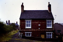
* Rumer Hill Junction and Lock Cottage 1958 (Arthur Watts, CRT Archive)
* Rumer Hill Junction and Churchbridge Top Lock (HNBC Philp Weaver)
Rumer Hill Open Cast Mine 1964 (Cambridge Air Photos)
Rumer Hill Basin 1955 (Stan Heaton / Hugh Potter Collection)
Rumer Hill Junction (Top Right) 1926 (Britain from Above)
* Rumer Hill Bridge April 1971 (Barrie Harley, Cannock Library)
Rumer Hill looking North 1926 (Britain from Above)
* Rumer Hill Bridge April 1971 (Barrie Harley, Cannock Library)
Looking South from Leacroft to Rumer Hill Bridge 1971 (Steve Lakin)
* Leacroft Bridge looking North 1962 (Tony Juke)
* Leacroft Bridge looking North (TW King)
* Looking North from Leacroft Bridge (Steve Lakin)
Looking West towards Park Bridge (Norton Swift)
* South to Leacroft Bridge
* Park Bridge looking South (Cannock Library)
* Spillway at Hawks Green looking South 1974 (Hugh Potter)
* Spillway at Hawks Green looking North 1974 (Hugh Potter)
Hawkes Green Lane Aqueduct (Terry Mears)
Hawkes Green Lane Aqueduct 1948 (Britain from Above)
Hawkes Green (Cannock Library)
* Hemlock's Farm from Canal (Deavalls Collection, Bob Williams)
* Hawkes Green to the Railway Bridge 1962 (Tony Juke)
* Hemlocks Bridge to Hednesford Basin 1962 (Tony Juke)
* Hednesford Basin drained for repair looking North 1959 (TW KIng)
* East Cannock Colliery and Hednesford Basin
Cannock Extension Part 1
These images are reproduced for ease of research are are not the property of this blog, and as such should
not be used for commercial gain without the explicit permission of the owner (whoever that may be).


Comments
Post a Comment