Bradley Locks, Gospel Oak and Monway Branch

Bradley Locks Branch


* Image colourised from black and white original


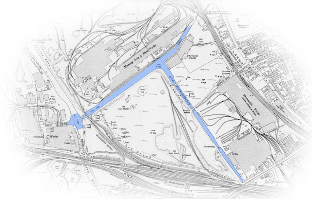
1:25000 Ordnance Survey Map 1920


Wednesbury Oak Loop & Bradley Locks Branch 1945 (Google Earth)


Weddell Wynd and Bradley Locks


Weddell Wynd 1939 (Britain from Above) 


* Bradley Junction 1958 (Roy Slater)


Bradley Junction (Vic Smallshire)


Bradley Locks 1-7


Locks 1-6 1951 (HNBC Philip Weaver)


* Top Lock and Cottage (Roy Perrin, BCRS)


* Zoom of above


* Locks 1-6 1960 (Brian Beagley)


Locks 1-6 (Vic Smallshire)


Locks 1-6


Locks 1-6 (BCNS)


* Locks 2-6 1956 (TW King)


* Locks 2-6 1956 (TW King)


Flight from tail of Lock 1 1988 (Duncan Moore)


* Locks 2-1 1960 (Brian Beagley)


* Lock 2 1957 (Arthur Watss CRT)


Lock 2-1 1960's (Ron Davies)


Lock 3 maintenance 1933 (TW King)


Locks 1-6 1949 (Britain from Above)


Locks 6-1


* Locks 6-4 (MACE Archive)


Locks 1-6 (Britain from Above)


Arm below lock 6 1949 (Britain from Above)


The Gordon Lido (Tipton and Black Country Group)


Locks 6-1 1965 (Ian Huselbee)


Locks 1-7 and Weddell Wynd from the Air 1949 (Britain from Above)


Locks 1-7 1969 (George Smallshire, DCTT)


Locks 1-7 1969 (George Smallshire, DCTT)


Locks 7-1 1965 (Ian Huselbee)


Locks 7-1 (Terry Langford)


Bradley Flight from the Air 1949 (Britain from Above)


* Lock 7


Bradley Flight from the Air 1949 (Britain from Above)


Bradley Flight from the Air 1949 (Britain from Above)


Bradley Branch before the Upper Locks were built 1841 (CRT)


Bradley Locks 8 to Moorcroft Junction


Locks 7-9 1949 (Britain from Above)


Lock 7 1949 (Britain from Above)


Lock 8-9 1966 (Peter Freakley)


Locks 8-9 1965 (Ian Huselbee)


Lock 9-6 1949 (Britain from Above)


Lock 8 1949 (Britain from Above)


South West from Viaduct (Goerge Smallshire, DCTT)


* Lock 9 1974 (Hugh Potter)


Lock 9


* Lock 9 1966 (Peter Freakley)


* Lock 9


* Lock 9 1970 (John Whitehouse)


Lock 7-9 1949 (Britain from Above)


From Moorcroft Junction 1979 (Alan T Smith)


Moorcroft Junction (Philip Weaver RCHS)


Gospel Oak Branch


Gospel Oak Branch (Wolverhampton Archives)


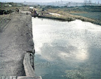
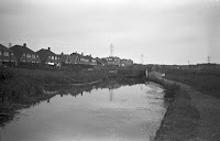
Junction from Walsall Canal 1966 (Ian Huselbee)


Gospel Oak Junction 1951 (Britain from Above)


Gospel Oak Junction 1967 (Ian Huselbee)


* Gospel Oak Junction 1970 (John Whitehouse)


Gospel Oak Junction 1977 (Keith Hodgkins)


* Willingsworth Road and Coppice Bridge 1969 (AH Price, Keith Hodgkins)


Patent Shaft from Coppice Bridge 1979 (Alan T Smith)


* Coppice Bridge 1969 (AH Price, Keith Hodgkins)


* Coppice Bridge (Richard Chester Browne)


Gospel Oak Branch 1949 (Britain from Above)


Willingsworth Wharf 1977 (Keith Hodgkins)


Willingsworth Furnaces (Keith Hodgkins)


Gospel Oak Branch 1945 (Google Earth)


Near Gospel Oak Wharf 1977 (Keith Hodgkins)


Gospel Oak Wharf 1979 (Trevor Whitehouse)


Gospel Oak Branch West 1949 (Britain from Above)


Wednesbury Oak Road Bridge 1960s (David Humphries)


Monway Branch


* Entrance Bridge 1974 (Hugh Potter)


Railway Bridge 1958 (Mark Hooper)


North East from 
Railway Bridge 1958 (Mark Hooper)


North East from 
Railway Bridge (Bournville Village Trust)


Monway Branch 1949 (Britain from Above)


The Turn 1956 (Mark Hooper)


The Turn 1959 (Mark Hooper)


The Turn Basin 1945 (Mark Hooper)


Monway Branch (History of Wednesbury)


Monway Branch 1924 (Britain from Above)


Terminus 
(JW Bernard, Mark Hooper)


Terminus 
1956 (Mark Hooper)


Terminus 
1959 (Mark Hooper)


Terminus (Mark Hooper)


Terminus (Mark Hooper)


Willenhall and Bilston Branch


Bilston and Willenhall Branch 1948 (Britain from Above)


Bilston and Willenhall Branch 1948 (Conurbation, BCNS)


Bilston Branch 1948 (Britain from Above)


Bilston Branch 1948 (Britain from Above)


Willenhall Branch 1952 (Ordnance Survey, Wolverhampton Archive)


These images are reproduced for ease of research, are not the property of this blog, and as such should 
not be used for commercial gain without the explicit permission of the owner (whoever that may be).


Comments

  1. These photos are brilliant and the houses in Rocket Pool and Gospel Oak have hardly changed as well. The shot showing the old house in Willingsworth is of course where Farmer Way was built. The area around the Gospel Oak branch, although often thought of as Tipton, was actually in Coseley Urban District

    ReplyDelete

Post a Comment

Popular posts from this blog

Contents

Wyrley , Essington, Lord Hays, Gilpins, Slough Sandhills and Hay Head Branches

Oldbury and Titford Area